Finding yourself – literally not figuratively – underwater is a central aspect of Project Baseline documentation. Our whole database structure is predicated on the assignment of spatial locations, i.e. latitude, longitude coordinates, to site and station level documentation efforts.
A not insubstantial problem for our teams has therefore been the acquisition of coordinates for the sites and stations they’re documenting. In many cases, the best they – and we – can do is to estimate locations from maps and charts or obtain GPS coordinates at the surface from the points of entry for dive sites. This is because GPS doesn’t work underwater – or does it…
Turns out there are some workarounds to the underwater GPS dilemma. Beto Nava, GUE instructor and underwater explorer, and the Bay Area Underwater Explorers (BAUE) developed a pretty simple method that leverages just about any handheld GPS and a watertight canister.
Beto found that he could get coordinates for any location underwater by enabling tracking on a handheld GPS; placing the unit in a buoyant watertight canister that he carries with him underwater; shooting the canister to the surface from the desired point; letting it sit there for a minute or two to acquire and record a location while he recorded the time, depth, and location name; then reeling it back down and moving onto the next location. After the dive, station locations could be parsed from the track file and assigned by correlating the GPS time to the dive time for each location. Beto developed a detailed how-to presentation that can be accessed here.

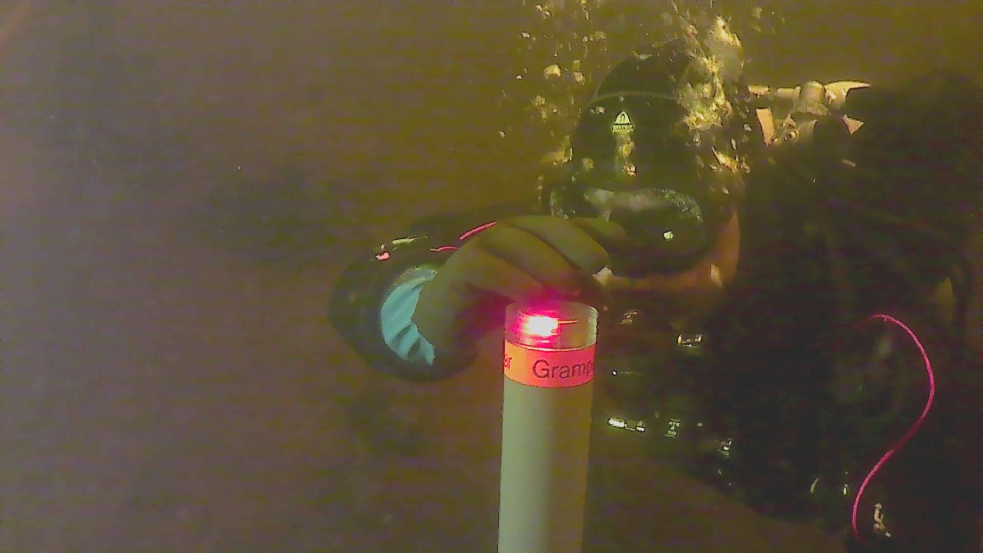
A somewhat more polished solution – and the impetus for writing this blog entry – is the Gramper GPS developed by Karst Braaksma and Leon van Kesteren, GUE divers and Project Baseline supporters from the Netherlands. The Gramper – named after a species of dolphin (Grampus griseus) because it too needs to come to the surface – works in much the same manner as Beto’s method.
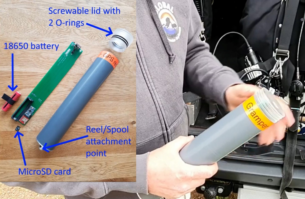
The great thing about the Gramper is that it is a fully functioning, standalone unit that has its own GPS and an indicator light that will confirm position acquisitions for the diver while underwater. Check it out on YouTube. As of June 6, Leon tells me that he and Karst are close to being able to sell them direct from their website.

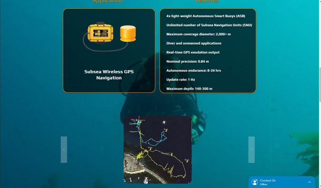
Want to go full James Bond? There are substantially more sophisticated tools available as well. One example is the DiveNET:GPS, a self-contained and rapidly deployable wireless wide-area underwater GPS navigation system, which is a fancy way of saying super accurate and expensive. The DiveNET:GPS and other similar devices combine one or more transponder buoys with receivers that one or more divers carry with them underwater.
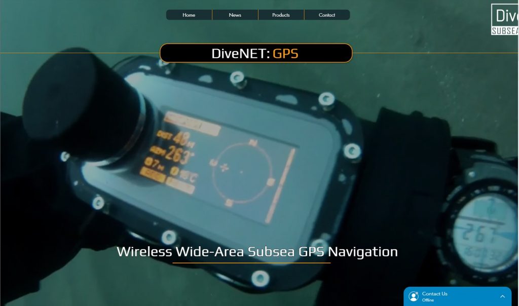
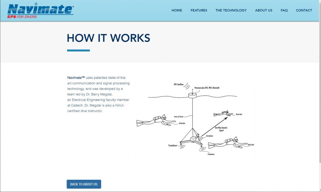
Essentially, these types of systems work by using a form of sonar to trac the position of the receiver (diver) relative to the surface buoy(s), which use GPS to establish their position and triangulation to establish and track the position of the divers beneath them. The receivers can be as simple as a watch-sized device attached to or worn by the diver, or in the case of the DiveNET:GPS, a Diver Display Unit designed to support route planning, navigating, and location marking by the diver while underwater down to a depth of 120m.
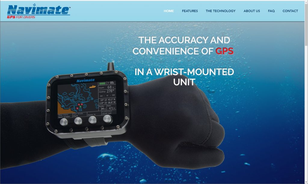
Though the high-tech tracking systems have traditionally been the traditionally targeted for military and commercial applications, they are making their way into the world of recreational and technical diving. One example – apparently not quite yet availabe for purchase – is the Navimate. The Navimate works in essentially the same manner as the DiveNET:GPS but has a receiver/display unit that is more tailored to applications such as Project Baseline and will likely be a fair bit less expensive as well. The Navimate website states that their target market price will be ~$3,000, $1,500 for the display unit and $1,500 for the gateway transponder system.
Turns out that Finding Yourself Underwater is a problem that many people in the world of underwater exploration have been struggling with for some time. And, as you might image, it has never been easier. So rather you go full James Bond or choose instead the DIY approach, pick and method that works for you and start recording those special underwater locations that you’re documenting for Project Baseline. We look forward to seeing your results!
Go Diving,
Record What you See,
Share it with the World…