mission that
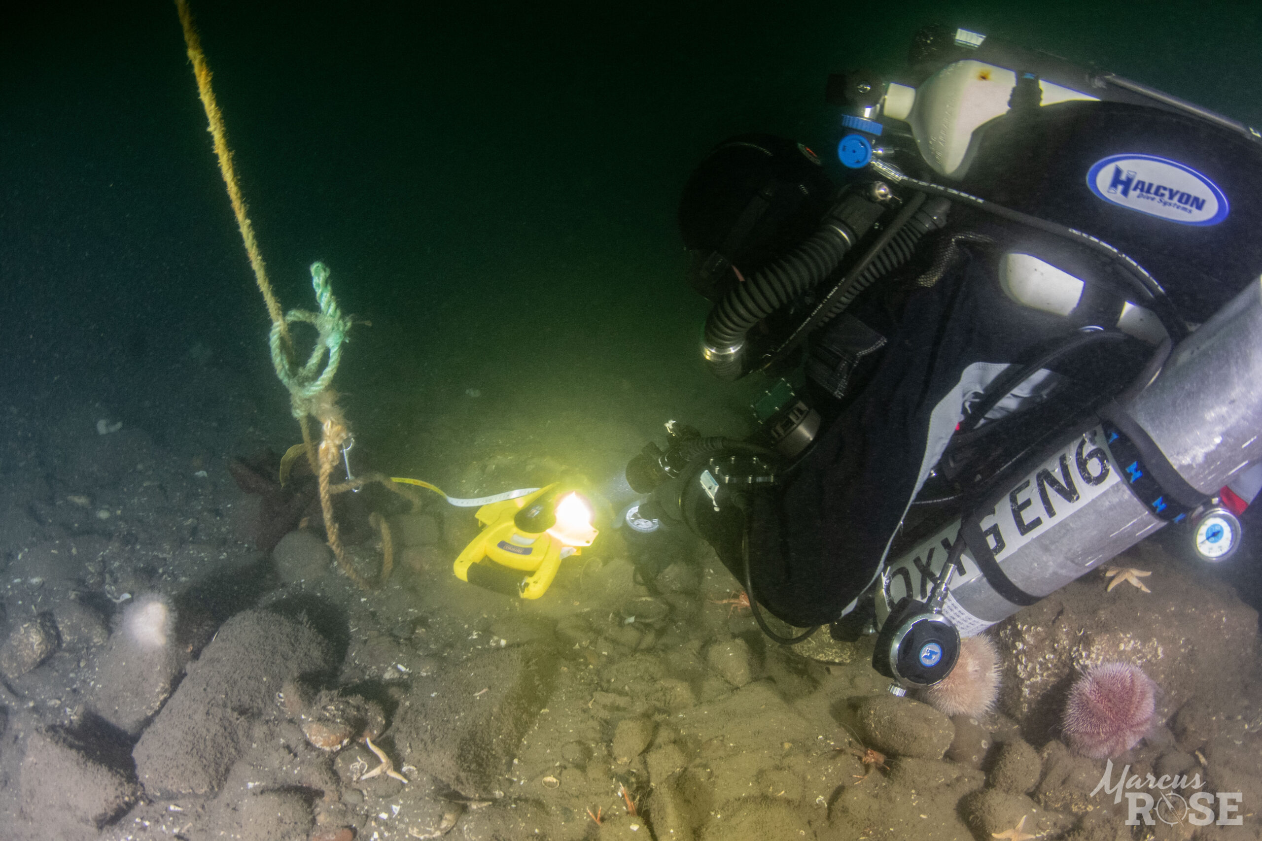
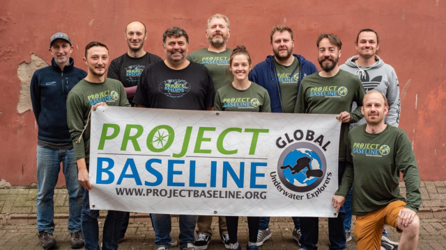
Project Baseline Missions are collaborative endeavors in which we either organize or help to organize opportunities to pair scientists with highly-skilled divers and sometimes larger-scale resources including manned submersibles and offshore support vessels to engage in surveys of critically important underwater environments or submerged cultural resources.
We Design and Execute Missions That...
DATA
Deliver new and scientifically defensible data to our collaborators.
ENGAGE
Provide opportunities for divers from any nationality or background to engage in exciting and scientifically important dives as volunteers.
PUBLIC
Provide opportunities for local public involvement.
OUTLETS
Engage the broader public through real-time coverage in print, web, and social media outlets.
We’re very proud to have executed the following missions since 2014.
MISSION: Thunder Bay, Michigan, USA, 2016
CONTENT IN PROGRESS. PLEASE CHECK BACK SOON!
MISSION: Shallow Coral Reefs, Fort Lauderdale, FL, 2016
CONTENT IN PROGRESS. PLEASE CHECK BACK SOON!
MISSION: Mesophotic & Shallow Coral Reefs, Bermuda, 2016
Mission: XL Catlin Deep Ocean Survey - Bermuda
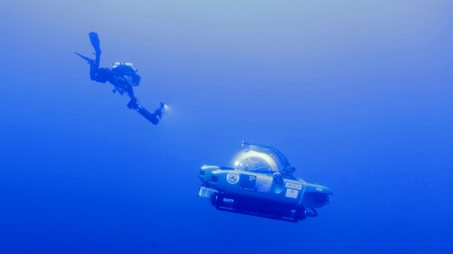
Project Baseline collaborated with Nekton and GlobalSubDive in 2016 to conduct Nekton’s first mission, the XL Catlin Deep Ocean Survey in Bermuda with the objective of initiating an Index for Ocean Health developed by the University of Oxford. Our team conducted 32 technical scuba dives and 77 submersible dives during which they collected video, still images, coral, algae, and water samples along 65 transects in depths between 120 and 300 meters and along 73 transects in depths between 15 and 90 meters; and assisted researchers with the deployment and retrieval of specialized sampling equipment. Outcomes included: confirmation of the discovery of the Rariphotic Zone - the Rare Light Zone – in depths from 130m to 300m; over 100 new species discovered; new multi-disciplinary research protocol to study the State of the Ocean – GOSSIP –The General Ocean Survey and Sampling Iterative Protocol (GOSSIP) - that aims to help transform understanding of the distribution patterns of deep sea life – and the environmental factors that influence them; 8 scientific papers published to date from the Bermuda Mission with 12 more in train; publication of new Identification Guide for Bermuda: to aid marine biologists, divers and naturalists with the identification of organisms; and curation of all specimens and samples from the Bermuda Mission in collections at the Bermuda Aquarium, Museum & Zoo.
Our dive team worked to support the objectives of six collaborating team members: Nekton, Univ. of Oxford, Stanford Univ, Trinity College, Salem State University and the Univ. of Puerto Rico. Our work for the University of Oxford included performing four 50-meter stereo video transects and four benthic video transects at 90, 60, 30, and 15 meters water depth at five different sites along the southern flank of the Bermuda rise; and collecting water samples to support Dr. Catherine Head’s work using environmental DNA to catalog species distributions. Our work for Stanford Univ. focused on the deployment and retrieval of a specialized piece of water sampling equipment called the Benthic Ecosystem Acidification Monitoring System (BEAMS) at multiple locations near our Bermuda dive sites. Our work for Trinity College and Salem State Univ. focused on the collection of algae samples from the transect depths. Our work for Dr. Schizas focused on the collection of coral and sponge samples to support his work on crypto fauna associated with corals and sponges.
Points of Contact –
- Nekton: Oliver Steeds, Nekton Mission Director - Nekton
- University of Oxford: Dr. Alex Rodgers, Chief Scientist – Univ. of Oxford
- University of Oxford: Dr. Catherine Head - Univ. of Oxford
- Stanford University: Heidi Hirsh - Stanford Univ.
- Trinity College: Dr. Craig Schneider - Trinity College
- Salem State University: Dr. Thea Popolizio - Salem State Univ.
- University of Puerto Rico: Dr. Nikolaos Schizas - Univ. Puerto Rico
Learn More:
MISSION: Battle of the Atlantic Shipwrecks, North Carolina, 2016
CONTENT IN PROGRESS. PLEASE CHECK BACK SOON!
MISSION: Mesophotic Reefs & Caves, Calanques, France, 2014
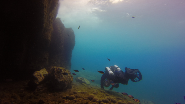
In 2014, GlobalSubDive created an opportunity for a mission collaboration between Project Baseline, Global SubDive, and the Global Underwater Explorers to survey shallow and mesophotic (meso = half, photic = light) habitats along the flanks of the steep limestone cliffs and islands comprising the Calanques National Park in southern France between Cassis and Marsellie, France; and the extensive Port Miou cave system that connects to the Mediterranean Sea in Cassis, France. The expedition was comprised of a team of deep technical divers operating down to a depth of 100 meters and two manned submersibles capable of operating to a depth of 300 meters.
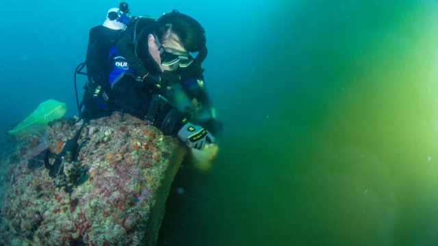
Within the Calanques National Park, our team conducted deep technical dives off the coast of Le Grand Congloue, which is an island off the point of Ile Riou at the southern boundary of the park. As we were working independently of a scientific partner, our work focused only on the collection of video transects along the base of the rock walls (~90 meters depth) and then progressively shallower up to ~15 meters depth. After the mission, all of the video surveys were made available to the Department of Biological Resources and Environment at the Ifremer Institute.
Our surveys revealed what appeared to be an excessive amount of algae growth. Surface reconnaissance revealed that, like south Florida, the City of Marseille is discharging partially treated wastewater directly to the Mediterranean Sea within the boundaries of the Calanques National Park.
At Port Miou, our team couldn’t resist the opportunity to investigate one of southern Europe’s longest underwater cave systems, as well as one that is integral to the City’s water supply. Port Miou cave has been explored to over 2,000 meters from its spring discharge in the Calanque de Port Miou at the edge of the city of Cassis. The cave system was targeted as a water supply in the 1970's, but before it could be used, a system had to be devised to manage the exchange between freshwater discharge to the Mediterranean Sea and saltwater intrusion to the aquifer. The targeted solution involved construction of a dam across the main, and apparently singular conduit, approximately 500 meters upstream from the entrance of the cave at the spring. The dam was constructed by drilling a large-diameter borehole into the cave at the target location through which workers were able to descend into the conduit, excavate and set up a base of operations, and then construct a wall. In order to permit controlled freshwater discharge to the spring, a ~1-meter diameter pipe was installed through the wall, which luckily permits passage of a fully equipped cave diver as well as the life-giving water.
At the time of construction, the cave had not been fully explored (it still isn’t) but the mapped trend of the explored portion indicated that it trended solitarily inland and into the recharge area from which it collects the freshwater that empties into the sea. At ~2,000 meters penetration, the cave turns however from its lateral trend at ~40 meters depth vertically where it descends down a shaft some 10 meters in diameter to unknown an unknown but one deeper than 170 meters. As it turned out, the dam failed to control the mixing of salt and fresh water and subsequent cave exploration and mapping revealed that, in all likelihood, a deeper conduit exists that leads to the sea well below the depth of the spring.
While the weather and seas were too rough for offshore diving, the Project Baseline team made two dives into the Port Miou cave system video-documenting the passage through the dam, back to, and down the shaft to ~110 meters depth.
Learn More:
- Calanques National Park
- Marseilles wastewater facilities
- Port Miou cave system
- PB-video: Underwater Surveys of Calanques NP
- PB-video: Underwater survey of Port Miou CS
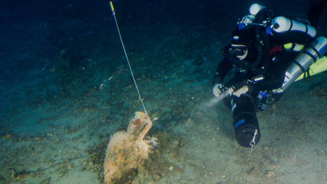
MISSION: Ancient Roman Shipwrecks, Lipari, Italy, 2014
CONTENT IN PROGRESS. PLEASE CHECK BACK SOON!
MISSION: Artificial Reefs, Fort Lauderdale, FL, 2015
In 2015, Global SubDive created an opportunity for a mission collaboration between Project Baseline, Global SubDive, Global Underwater Explorers, and the Nova Southeastern University to initiate an ongoing effort to survey fish populations on artificial reefs (aka shipwrecks) off the coast of SE Florida by conducting a 3-day mission to survey the wreck of the Lawrence, which sits in approximately 60 meters of water off the coast of Fort Lauderdale. The science team, led by Dr. Brian Walker, developed a protocol for conducting video transects along the length of the wreck at multiple depths from the sand up to the superstructure.
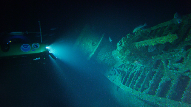
The mission team including two Triton submarines capable of operating down to a depth of 300 meters and four deep technical divers capable of operating down to a depth of 100 meters. Together, the team conducted video surveys following Dr. Walker’s protocol, standard photography, and 360-degree photography at multiple stations. The mission also carried NOAA personnel to observe operations in anticipation of developing an ongoing collaboration between NOAA and Project Baseline.
MISSION: Blue Holes, Andros, Bahamas, 2014
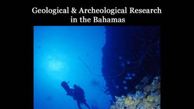
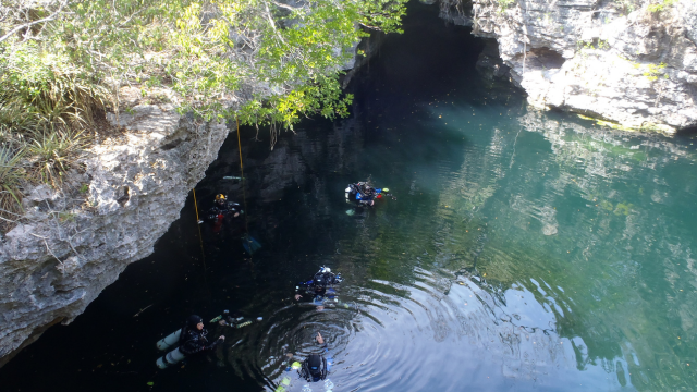
In 2014, Global SubDive created an opportunity for a mission collaboration between Project Baseline, Global SubDive, Global Underwater Explorers, and the Bahamas Cave Research Foundation to plan and execute a series of cave dives into five Blue Holes: Stargate, Eldorado, Benjamin’s Blue Hole, Kemps Bay-1 and Andros Cracks. The expedition was comprised of a team of deep technical divers operating down to a depth of 100 meters. The team conducted video surveys of the cave basins and cave passages, recorded vertical and lateral water quality distributions, and documented archeological/anthropological remains at various depths and locations within the largest caves.
MISSION: Blue Holes, Andros, Bahamas, 2014
In 2014, GlobalSubDive created an opportunity for a mission collaboration between Project Baseline, GlobalSubDive, Global Underwater Explorers, and the Bahamas Cave Research Foundation to plan and execute a series of cave dives into five Blue Holes: Stargate, Eldorado, Benjamin’s Blue Hole, Kemps Bay-1 and Andros Cracks. The expedition was comprised of a team of deep technical divers operating down to a depth of 100 meters. The team conducted video surveys of the cave basins and cave passages, recorded vertical and lateral water quality distributions, and documented archeological/anthropological remains at various depths and locations within the largest caves.
MISSION: Mesophotic Reefs, Oculina Bank, Florida, 2014 - 2015
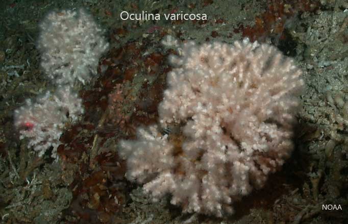
Global SubDive created two opportunities for a mission collaboration between Project Baseline, GlobalSubDive, Global Underwater Explorers, and the Harbor Branch Oceanographic Institute to survey several sites off the coast of Fort Pierce, Florida thought to support a deep water species of coral known as Oculina varicosa. Our first mission targeted Jeff’s Reef where HBOI had documented colonies of Oculina varicosa has tall as two meters in the 1980’s and early 1990’s. HBOI’s documentation there led to the area becoming established as a Habitat of Particular Concern (HPAC), which carries protections from fishing and anchoring. The Project Baseline team returned to Jeff’s Reef in 2014 (water depths of between 80 and 90 meters) with a technical dive team and discovered that, despite the HPAC protections, the entire reef had been decimated, apparently due to bottom trawl fishing.
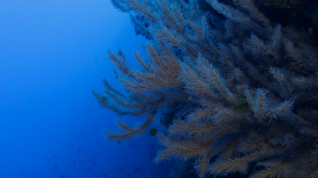
Our second mission in 2015, led by Dr. Josh Voss from HBOI, involved surveying an area immediately south of the HPAC boundaries in water depths of between 60 and 90 meters using technical divers and manned submersibles. The objectives were: 1) to develop collaborative at-sea capabilities between Harbor Branch-FAU and Project Baseline, 2) to locate and document the Oculina reefs, and 3) to assess any damage to the reef, such as that caused by trawling. Although the Oculina fields reported decades before were once again not observed, our team located a vast field of the black coral Stichopathes over a reef habitat likely comprised of ancient compressed Oculina skeletons. Throughout the dives, although they found evidence of human debris on the reef, the team also discovered that the reef is providing habitat for deepwater reef fish, sea bass, and snowy grouper. Our divers were also able to collect samples of three black coral species and several sponges for morphometric and genetic analyses.
Learn More
- NOAA - Oculina varicosa
- HBOI - 2015 Cruise Report
- HBOI - Effects of Bottom Trawling on Jeff’s Reef
- HBOI - Video: Jeff’s Reef circa 1990
- PB - Video: Jeff’s Reef 2014
- HBOI/PB - Video: 2015 Mission Summary
MISSION: Coral Reef Eutrophication, Florida, 2014 - 2015
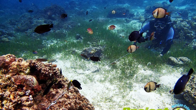
GlobalSubDive created two opportunities for a mission collaboration between Project Baseline, GlobalSubDive, Global Underwater Explorers, and the Harbor Branch Oceanographic Institute to survey several coral reef sites off the coast of Florida in 15-30 meters water depth between West Palm Beach and Looe Key in 2014 and 2015. For both missions, the science team, led by Dr. Brian Lapointe, devised and participated in a series of survey dives aimed at documenting the extent, magnitude, and type of excessive algae growth over coral colonies due to nutrient pollution. Our team conducted video transects, collected algae samples from the coral beds, and collected water samples and video from five wastewater outfalls. Though some beautiful coral colonies persist particularly in the Florida Keys, outcomes of our missions confirmed and brought public attention to what was already known in the scientific community; that Florida has lost 90% or more of its living coral cover due, in part to nutrient pollution from wastewater and agricultural runoff.
Learn More
- HBOI - HAB Research Sites
- HBOI - Macroalgae Blooms on Florida’s SE Coral Reefs - I
- HBOI - Macroalgae Blooms on Florida’s SE Coral Reefs - II
- Slate.com - Don’t Eat the Grouper
- KeyWest News - Eutrophication of Florida’s Coral Reefs
- HBOI - Video: Algae Killing Florida’s Coral Reefs
- PB/HBOI - Video: Water Quality on Florida’s Coral Reefs
- PB/HBOI - Video: Eutrophication - the Death of Florida’s Coral Reefs
MISSION: Mesophotic Black Coral Reefs, Azores, Portugal, 2014
GlobalSubDive created an opportunity for a mission collaboration between Project Baseline, GlobalSubDive, Global Underwater Explorers, and the University of the Azores (IMAR/DOP-UAç) in 2014 to survey several mesophotic Black Coral reefs throughout the islands and shallow seamounts comprising the Azores Archipelago. The science team, led by Dr. Pedro Ribiero, devised and participated in a series of survey dives conducted for a period of 10 days aimed at documenting distributions of black coral along the deep water slopes.
The expedition team including two Triton submarines that operate to a depth of 300 meters, a deep technical dive team that operates to a depth of 100 meters, a shallow dive team operating above 40 meters depth, mostly comprised of the scientists conducting biological sampling. Together, the team conducted detailed video surveys and collected important samples from some of the most charismatic marine areas of the Azores. These included the Princess Alice Bank, the Pico-Faial Channel, Calheta do Nesquim (south coast of Pico), D. João de Castro Bank and the Formigas Bank.
Dozens of species, including some invasive ones, as well as geological underwater formations were documented on video and photo. Several black coral gardens, which are fundamental for the structuring of benthic communities in the Azores, were mapped. Nearly 200 specimens were collected, which were used for validation of video surveys and habitat predictive models, and for further studies in the scope of ongoing research projects. Detailed descriptions of the selected sites were compared with previous surveys in the cases where they exist and established new baselines for the areas that had never been surveyed previously.
Despite the presence of recent fishing gear in some of the protected areas visited, the communities appear healthier than in previous visits, but not yet completely restored. These observations stress the need for a strict respect for the existing regulations on the use of the oceans surrounding the Azores. The success of our mission stemmed largely thanks to the collaboration of the Government of the Azores and the Portuguese Navy, who supported all the legal procedures required for the mission.
Learn More
- Alantico Esxpresso - Mission Summary
- PB - Video: Mission Summary
- Univ. Azores - Black Coral
MISSION: Mesophotic Red Coral Reefs, Algarve, Portugal, 2014
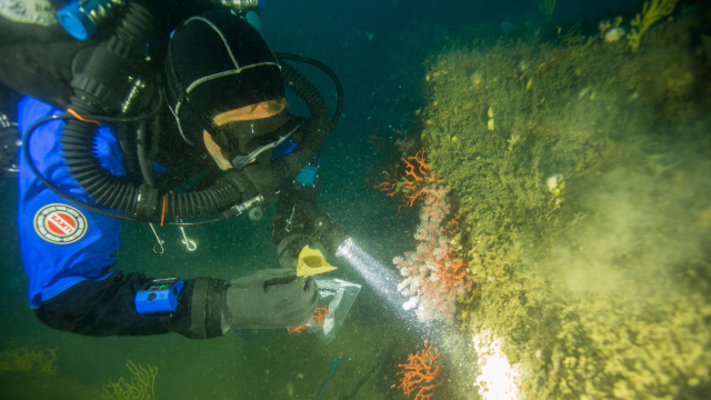
GlobalSubDive created an opportunity for a mission collaboration between Project Baseline, GlobalSubDive, Global Underwater Explorers, and the University of the Algarve (CCMAR) in 2014 to survey several mesophotic (meso = half, photic = light) red coral (Corallium rubrum) and gold coral (Savalia savaglia) reef sites along the south coast of Portugal (Algarve). The science team, led by Dr. Joana Boavida, devised a series of survey dives conducted over a period of 5 days aimed at documenting the distributions of red coral in the Algarve region.
The expedition team including two Triton submarines capable of operating down to a depth of 300 meters and four deep technical divers capable of operating down to a depth of 100 meters. Together, the team conducted video surveys, photography, measured basal diameters in situ, estimated colony density and collected samples from five sites at water depths of between 60 and 90 meters. Outcomes from the mission developed for/by the CCMAR scientists included:
identification of 42 different species living on the red coral sites; discovery of two new sites containing red coral resulting in a revised understanding of red coral distributions in the northwestern Mediterranean Sea; collection of forty coral samples suitable for molecular analysis; correlation of red coral habitats to vertical walls and protected overhangs indicating that protection from trawl/dredge fishing is critical to coral survival; documentation of damage from trawl/dredge fishing on flat tops of rocky outcrops; documentation of extensive areas of small coral growth in conjunction with larger broken colonies indicating recovery from damaging fishing practices; and between 4 and 26 lost fishing nets and cables at each of the dive sites.
CCMAR summarized the mission success as follows…
“Thanks to Project Baseline’s resources, we identified the need to
classify this site as a Natura 2000 Network (EU Habitats Directive), to
substitute destructive fishing practices that operate too close to the
bottom by non-destructive fishing and support continued police
enforcement to prevent illegal catch.”
- CCMAR - Published Mission Summary
- CCMAR - Published Mission Outcomes (PLOS One)
- VISAO Magazine - In Search of Red Coral
- PB - Video: Mission Dive
- Smithsonian Institute - Deep Sea Corals
PB UK, Blue Marine Foundation, & The University of Plymouth
Following a successful first mission in 2021 Project Baseline UK again teamed up with the Blue Marine Foundation in June 2022. For this second iteration of the project the mission was also supported by the Sea-Changers Marine Conservation Charity and by 2 Plymouth University students. Read the Project Report.

